Learn about the Weather with the Whirlydoodle !
Top ten weather events to see with a Whirlydoodle:
The wind is ideal for a Whirlydoodle light show, a dynamic and ever-changing force of nature, somewhat unpredictable, and influenced by everything from the prevailing weather system to your local terrain. All weather events have characteristic patterns associated with the wind and these patterns are dramatically displayed by the Whirlydoodle. Your local wind is the complex result of the season, prevailing weather pattern, time of day, geography and your terrain. And don’t forget other factors like temperature and water.
Micro winds occur at your location are the result of trees, buildings and other obstacles close by that deflect or concentrate the wind. The wind is supplied by the prevailing weather, time of day, geography, the surrounding terrain and more. Winds tend to rise and fall quickly with frequent changes in direction.
Local and small- scale winds are specific to your location and the terrain. Wind passing between hills, through valleys or canyon walls will tend to concentrate and speed up. Obstructions, like hills and mountains also cause friction that cause air to slow down and become turbulent. Wind speeds, generally, increase with altitude because of less friction.
Sea, land and lake breezes all have distinct behaviors but tend to persistent directional winds and follow a day/night pattern shift.
Mountain and valley winds occur on a larger scale. In the daytime air that is next to a mountain slope and heated by the sun and tends to flow upslope at it rises. Air in the valley isn't heated as much and actually descends downward into the valley. At night the opposite happens, the cool air sinks along the mountain slopes resulting in a downward mountain breeze when that rustles the trees outside the window and typically gives the Whirlydoodle a consistent glow.
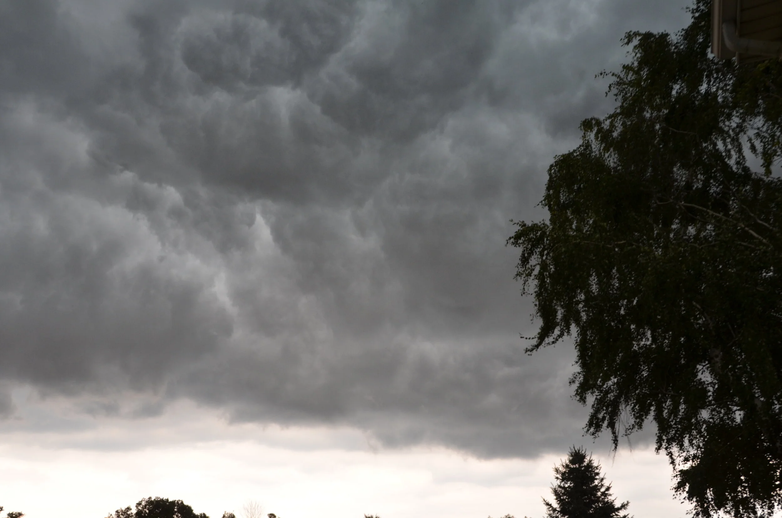
Thunderstorms are amazing events in nature and fascinating to watch with a Whirlydoodle. Just be sure to be in a safe place if you want to watch the whole show. Thunderstorms are fairly small and temporary blips in the atmosphere, often between five and 30 miles in diameter and with an average life cycle lasting just a few hours. They can occur in clusters or long lines across the landscape and are often associated with warm or cold fronts. As a thunderstorm matures rain begins to fall from the cloud, it causes a high velocity downdraft that hits the ground and spreads out causing what is called a plow wind- it's a cool straight line wind you'll temporarily feel from a thunderstorm.
Plow winds often cause the most storm damage. You may notice the Whirlydoodle first responding to mild, confused gusts of wind preceding the plow wave and then showing continuous bright blended color blur at full speed for several minutes. Typically the storm moves overhead and the downdraft actually caused surface winds to switch direction.
Squall lines often precede a line of thunderstorms and generally form in front of a cold front. They can appear a 100 miles in front of an approaching cold front and are a persistent and strong flow of wind, often accompanied by sheets of rain.
Blizzards are local favorites here in Michigan, and best observed from a warm location. Basically they are consistent winds with occasional gusts and blowing snow. The white snow is an excellent light reflector as the colors play off the snow.
Gradient winds are caused by differences in air pressure. As air flows from a high pressure area to low pressure area, it typically follows a curved path due to the Coriolis force caused by the Earth’s rotation.
Seasonal wind patterns are apparent. Here in the Midwest of the United States, springtime winds are frequently warm and cold fronts passing through with strong gusts and possible rain or thundershowers. Lots of wind direction changes. The summers tend to be more tranquil with occasional thunderstorms and strong fronts causing the most interest. In the fall the winds to be out of the north or northwest and tend to be strong.
In the fall the winds to be out of that the north or northwest and tend to be strong and consistent with occasional gusts.
Winter is another great time for Whirlydoodles. The lack of foliage from deciduous trees reduces the friction close to the ground and wind speeds tend to be higher. And we get a transient movement of air masses across the region. Snowstorms and blizzards are excellent because they offer consistent winds and a slow change in wind direction.
Katabatic or fall winds are masses of dense air flowing down from a high elevation. Caused by air cascading down slope from a high altitude region, they include the Bora winds flowing down from the Alps. Closer to home, we have Chinook winds which blow from the eastern slops of the Rockies out and over the Great Plaines. Santa Ana winds from the Sierra Nevada and Chinook can become quire warm as they descend and compress. These winds can be quite strong and may reach hurricane force.
Microbursts are a small column of rapidly descending air from a thunderstorm or rain shower. They are about 1 to 2 miles in diameter and pass relatively quickly with a large change in wind direction. You may notice a darkish “rain shadow” underneath the passing cloud.
Tornados, hurricanes and typhoons – Move yourself to safety! Take the Doodle if you can.
Please feel free to send us your suggestions, changes and corrections to the page.